Friday, December 30, 2011

Christmas Weekend - Travel

Three days in succession to go without being in the Temple where we serve is unusual.  However, Christmas is always a time for families, good food at home and fun.  Because we don't have any family close by again we traveled from Saturday through Monday, three days and two nights.  Our first stop was Ica, about five hours south of Lima.  Cruz del Sur bus lines is an excellent way to put away the miles in comfort.  Our initial stop in Ica was at Paracas, a fishing village on the Pacific.  With the advent of summer, flowers were everywhere.  Tropical yet arid is unusual but that's what you see along most of the coast of Peru.  Oasis areas host the tired and hungry and are accented with flowers and flowering trees. 

Acacia trees were in full bloom beside the mesquites and bougainvilleas.    Palms are not indigenous to Peru but were brought here by the Spanish centuries ago.  Many continue to flourish and spread while remnants are visible in poorly maintained areas.  Peru is a poor country filled with hope but signs of disappointment exist where speculation failed.  

Old style mail drops decorate the entrance to this hotel area adding color and charm to the adobe walls now plastered and painted.  A short drive down the road brought us to a true Oasis of palms and man-made pools nestled beneath as the sand dunes  rise high above inviting dune buggy running.  Tourism is vital to this economy.  Currencies readily accepted are the Euro, Dollar and local Sole.  Conversion rates are competitive in most areas.  Currently the Sole is trading S/.2.70 to $1 and staying steady.  Our cash card from Wells Fargo works like a charm at ScotiaBank ATM's everywhere. 

The Oasis included a walking path surrounding the water with shops, sidewalk vendors and locals enjoying the afternoon.  This Peruvian woman slept peacefully as we walked by, snapping this photo and then visiting with the street vendors selling jewelry.  Claudia has a new necklace they had made, costing S/.10 or about $4. 

Families relaxed under the shade but the air temperature was very comfortable.  It is wise to take a hat for protection from the direct sun.  All the locals wear them.  Below a family of a granddad, daughter and her two children chatted with us while I took their picture.  The youngsters loved to see themselves.  People are friendly, open and conversant no matter my limited language capacity.  I've been told they will help me out and they did.  We used everything from my poor Spanish to hand signals and humor to converse. 


This traveler appears to be thinking of food, again.  If you love chicken, vegetables, fish, vegetables, rice and vegetables, you will never go without.  Restaurants are all good, unique and love the tourists because we keep them alive, literally.  Locals don't have the resources to trade there too often. 

 Having absolutely no knowledge of grapes, I decided to try my hand at raising them at home.  They do grow very well so under the blanket of snow lies the one year old roots of my vineyard, all 60 feet of it.  One day it will bear the four varieties in planted and I'll harvest about 50 kilos of grapes.  Some for grape juice and some for table use and raisins.   By the way, the raisins in Peru are the size of my thumb.  I thought they were prunes at first. 


The sign below advertises Piscos y Vinos.  Knowing nothing I learned Piscos to be a second process of distilling the Vino into a 50 proof drink.  Vinos are the ordinary wine made of whatever grape they grow.  Piscos contain more than one grape variety. 


This little winery is self contained on the vineyard site.  Within the property boundarys the grapes grow to maturity, are harvested and made into both products.  The harvest season for these grapes is February.  The vines were laden with growing grapes still green but slowly they will mature and turn dark.  The actual variety is  probably on their website. 


Wine is stored in ceramic kegs shown here.  All the work is done by hand.  It's a fascinating process and manned by hard working farmers.  Their success depends on their labors by hand.  No sight of mechanized equipment.  Gravity distributes the water nourishing the trees in flooded style.  Water is plentiful despite the arid climate.  Underground aquifers supply the wells that flow to the fields.  

The following day we traveled to Nasca where the famous NASCA Lines are located.  Outside the airport this native was chatting with his friends in the shade.  His look was ominous but friendly.  Such character in all these faces.  I could take pictures all day and never run out of materials to photograph.  No requests for autographs yet. 

Peruvian culture is generally depicted in art, just as it is in most places.  The Native American heritage of Peru is one of the richest in South America. Although Spain gave Peru its language, religion, and rulers, the civilization of the Inca has left its traces throughout Peruvian culture. Archaeological excavations have uncovered monumental remains of Native American societies. Architecture of the Spanish colonial period, a fusion of Spanish and Native American forms, is called Creole.  The descendants of the Quechua and Aymará peoples populate the Andean highlands. Many do not speak Spanish and have preserved the customs and folklore of their ancestors. Along the coast and in the highland cities, the whites, mestizos, and blacks live in a modern Western style. In contrast to these settlements are the jungles of eastern Peru, where more isolated groups of Native Americans retain lifestyles similar to those of their ancestors.

Next we hired a plane to fly us over the Nasca

The Nazca Lines are a series of ancient geoglyphs located in the Nazca Desert in southern Peru. They were designated a UNESCO World Heritage Site in 1994. The high, arid plateau stretches more than 80 kilometres (50 mi) between the towns of Nazca and Palpa on the Pampas de Jumana about 400 km south of Lima. Although some local geoglyphs resemble Paracas motifs, scholars believe the Nazca Lines were created by the Nazca culture between 400 and 650 AD.[1] The hundreds of individual figures range in complexity from simple lines to stylized hummingbirds, spiders, monkeys, fish, sharks, orcas, llamas, and lizards.

The lines are shallow designs made in the ground by removing the ubiquitous reddish pebbles and uncovering the whitish ground beneath. Hundreds are simple lines or geometric shapes; more than seventy are zoomorphic designs of animals such as birds, fish, llamas, jaguar, monkey, or human figures. Other designs include phytomorphic shapes such as trees and flowers. The largest figures are over 200 metres (660 ft) across. Scholars differ in interpreting the purpose of the designs, but in general they ascribe religious significance to them.
The geometric ones could indicate the flow of water or be connected to rituals to summon water. The spiders, birds, and plants could be fertility symbols. Other possible explanations include: irrigation schemes or giant astronomical calendars.[2]
Due to the dry, windless, and stable climate of the plateau and its isolation, for the most part the lines have been preserved. Extremely rare changes in weather may temporarily alter the general designs.


After people travelled over the area by plane in the 1930s and saw the Nazca Lines from the air, anthropologists started studying them, with focus on trying to understand how they were created.
Scholars have theorized the Nazca people could have used simple tools and surveying equipment to construct the lines. Studies have found wooden stakes in the ground at the end of some lines, which support this theory. One such stake was carbon-dated and the basis for establishing the age of the design complex. Researcher Joe Nickell of the University of Kentucky has reproduced the figures by using tools and technology available to the Nazca people. The National Geographic called his work "remarkable in its exactness" when compared to the actual lines.[3] With careful planning and simple technologies, a small team of people could recreate even the largest figures within days, without any aerial assistance.[4]
On the ground, most of the lines are formed by a shallow trench with a depth of between 10 cm (3.9 in) and 15 cm (5.9 in). Such trenches were made by removing the reddish-brown iron oxide-coated pebbles that cover the surface of the Nazca desert. When this gravel is removed the light-colored earth which is exposed in the bottom of the trench produces lines which contrast sharply in color and tone with the surrounding land surface. This sublayer contains high amounts of lime which with the morning mist hardens to form a protective layer that shields the lines from winds, thereby preventing erosion.
The Nazca "drew" several hundred simple but huge curvilinear animal and human figures by this technique. In total, the earthwork project is huge and complex: the area encompassing the lines is nearly 500 square kilometres (190 sq mi), and the largest figures can span nearly 270 metres (890 ft). The extremely dry, windless, and constant climate of the Nazca region has preserved the lines well. The Nazca desert is one of the driest on Earth and maintains a temperature around 25 °C (77 °F) all year round. The lack of wind has helped keep the lines uncovered and visible to the present day.
 Purpose:
Archeologists, ethnologists, and anthropologists have studied the ancient Nazca culture and the complex to try to determine the purpose of the lines and figures. One hypothesis is that the Nazca people created them to be seen by their gods in the sky. Kosok and Reiche advanced a purpose related to astronomy and cosmology: the lines were intended to act as a kind of observatory, to point to the places on the distant horizon where the sun and other celestial bodies rose or set. Many prehistoric indigenous cultures in the Americas and elsewhere constructed earthworks that combined such astronomical sighting with their religious cosmology, as did the later Mississippian culture at Cahokia in present-day United States. Another example is Stonehenge in England. But, Gerald Hawkins and Anthony Aveni, experts in archaeoastronomy, concluded in 1990 that there was insufficient evidence to support such an astronomical explanation.[5]

In 1985, the archaeologist Johan Reinhard published archaeological, ethnographic, and historical data demonstrating that worship of mountains and other water sources predominated in Nazca religion and economy from ancient to recent times. He theorized that the lines and figures were part of religious practices involving the worship of deities associated with the availability of water, which directly related to the success and productivity of crops. He interpreted the lines as sacred paths leading to places where these deities could be worshiped. The figures were symbols representing animals and objects meant to invoke the gods' aid in supplying water. But, the precise meanings of many of the individual geoglyphs remain unsolved as of 2011.
Henri Stierlin, a Swiss art historian specializing in Egypt and the Middle East, published a book in 1983 linking the Nazca Lines to the production of ancient textiles that archeologists have found wrapping mummies of the Paracas culture.[6] He contended that the people may have used the lines and trapezes as giant, primitive looms to fabricate the extremely long strings and wide pieces of textile that are typical of the area. By his theory, the figurative patterns (smaller and less common) were meant only for ritualistic purposes.

Our visit to Paracas was enlightening
The Paracas culture was an important Andean society between approximately 800 BCE and 100 BCE, with an extensive knowledge of irrigation and water management. It developed in the Paracas Peninsula, located in what today is the Paracas District of the Pisco Province in the Ica Region. Most of our information about the lives of the Paracas people comes from excavations at the large seaside Paracas site, first investigated by the Peruvian archaeologist Julio Tello in the 1920s.

The Paracas Cavernas are shaft tombs set into the top of Cerro Colorado, each containing multiple burials. There is evidence that these tombs were reused over centuries. In some cases the heads of the deceased were taken out, apparently for rituals, and later reburied. The associated ceramics include incised polychrome, "negative" resist decoration and other wares of the Paracas tradition. The associated textiles include many complex weave structures as well as elaborate plaiting and knotting techniques.

The necropolis of Wari Kayan consisted of two clusters of hundreds of burials set closely together inside and around abandoned buildings on the steep north slope of Cerro Colorado. The associated ceramics are very fine plain wares, some with white and red slips and other with pattern-burnished decoration, and other wares of the Topara tradition. Each burial consisted of a conical textile-wrapped bundle, most containing a seated individual facing north across the bay of Paracas, next to offerings such as ceramics, foodstuffs, baskets and weapons. Each body was bound with cord to hold it in a seated position, before being wrapped in many layers of intricate, ornate, and finely woven textiles. The Paracas Necropolis embroideries are now known as some of the finest ever produced by Pre-Columbian Andean societies, and are the primary works of art by which Paracas is known. Burials at the necropolis of Wari Kayan continue until about 250 CE, and many of the mortuary bundles include textiles like those of early Nazca.

The Paracas Candelabra, also called the Candelabra of the Andes, is a well-known prehistoric geoglyph found on the northern face of the Paracas Peninsula at Pisco Bay in Peru. Pottery found nearby has been radio carbon dated to 200 BCE, the time of the Paracas culture. The design is cut two feet into the soil, with stones possibly from a later date placed around it. The figure is 595 feet tall, large enough to be seen 12 miles at sea.[1]
It is approximately 595 feet long, and is visible for several miles out to sea. The geoglyph consists of 2-foot-deep (0.61 m) trenches carved into the hillside and stones used to mark its edges. Other lines are also carved into the hillside near it.
Local tradition holds that it represents the lightning rod or staff of the god Viracocha, who was worshipped throughout South America.[1] A variety of popular myths have arisen: one attributes it to José de San Martín; another suggests it is a Masonic symbol (see Freemasonry); and yet another that sailors created it as a sign which they could view at sea for landfall.

Visitors to the Candelabra should view the site under the supervision of a responsible and accredited guide.
While the Paracas culture developed in this region between about 1200 BCE and 100 BCE, the Topará culture is thought to have invaded from the north at approximately 150 BCE. The two cultures then coexisted for one or more generations, both at this site and in the nearby Ica Valley, and their interaction played a key role in the development of the Nazca culture and ceramic and textile traditions. Though the elaborate textiles have only been preserved in the coastal desert sites, there is growing evidence that people associated with these cultures lived and traveled between the Pacific lowlands and the Andean highland valleys and mountain pastures to the east.

 Although the exact age of the Candelabra geoglpyh is unknown, archaeologists have found pottery around the site dating back to around 200 B.C. This pottery likely belonged to the Paracas people, although whether they were involved in the creation of the geoglyph is not known. The reason for the Candelabra's creation is also unknown, although it is most likely a representation of the trident, a lightning rod of the god Viracocha, who was seen in mythology throughout South America. It has been suggested that the Candelabra was built as a sign to sailors, or even as a symbolic representation of a hallucinogenic plant called Jimson weed.

Paracas bay, with its southern end lying within the Paracas National Reservation is well-known for its abundant wildlife. The unique ecosystem, insulated from thrashing ocean waves and current by Paracas Peninsula, and its shallow warmer waters, stimulates a remarkable growth of seaweed for which much of the wildlife, particularly the birds of Paracas, thrive upon directly or indirectly.

The bay appears as the gateway to Paracas National Reserve, its warmer shallow waters foster wildlife and many nautical sports, and its calm shoreline protects the municipality of Paracas and the various cottages and hotels that have sprung up in the last few years. As of recent years, the bay has hosted many sailors on catamarans and kitesurfers seeking the flat water and strong wind found in the bay.


Back on land, the villages beckoned us to see them up close.  Such color and diversity of economic development from street vendor to prosperous business coexist in sight and reach of one another. 

Our final visit was to the Chauchilla Cemetery discovered on the high desert south of the city.  Then it was back on the bus for three movies and 9 hours before we are back in our apartment.  But, it was a good weekend filled with sights, smells, and of course the sounds of Peru,  where there is always action except when its quiet, and that's usually between 2:00am and 4:00am.  

The cemetery was discovered in the 1920s,[3] but had not been used since the 9th century AD. The cemetery includes many important burials over a period of 600 to 700 years. The start of the interments was in about 200 AD. It is important as a source of archaeology to Nazca culture.[4] The cemetery has been extensively plundered by huaqueros who have left human bones and pottery scattered around the area.[4] Similar local cemeteries have been damaged to a greater extent.[2] The site has been protected by Peruvian law since 1997 and tourists pay around seven U.S. dollars to take the two hour tour of this ancient necropolis.[2] The site is by the Poroma riverbed and can be accessed off a dirt track from the Panamerican Highway.[4] In 1997, the majority of the scattered bones and plundered pottery were restored to the tombs.[1]
The tombs were built for family groups


Preservation of the bodies
The bodies are so remarkably preserved due mainly to the dry climate in the Peruvian Desert but the funeral rites were also a contributing factor. The bodies were clothed in embroidered cotton and then painted with a resin and kept in purposely built tombs made from mud bricks. The resin is thought to have kept out insects and slowed bacteria trying to feed on the bodies.[1]
The nearby site of Estaquería may provide clues to the remarkable preservation of the numerous bodies in these cemeteries. At that site, Archeologists found wooden pillars initially thought to have been used for astronomical sightings.[5] However, it is now believed that the posts were used to dry bodies in a mummification process.[2] This may account for the high degree of preservation seen in thousand-year-old bodies which still have hair and the remains of soft tissue, such as skin.


 Finally, to preserve our own bodies, we had lunch in Nasca at a local favorite restaurant with two of the Elders assigned to Nasca, Elder Brown (from Arizona) and Elder Hoyos (from Colombia)  We tried to fill them up but you know young men and their appetites for good food.  We had a great visit with them.  They serve there along with 8 other young men and one adult couple hoping to create a stake in Nasca within the next few years.  People are growing stronger in their Spirituality every week, attending and serving faithfully.  All good signs of strong development. 

As we said goodbye to the missionaries there, they took us to the corner store owned by the local branch leader.  We met his family as well.  He had a rich selection of junk food that rivals anything I had seen anywhere, even as a young boy, and I was a local favorite as a customer.  I specialized in penny candy taking my time selecting just the right assortment of sen sen, pop in wax, red was lips and candy cigarettes,,such a nice peppermint flavor if you're that old.  This traveler appears to be stocking up on liquids for the ride home. 

Posted by Picasa

Monday, December 19, 2011

Mobility is never limited - Traffic and Autos or Peds.

     Lima, a city of over 9.5 million, is widely diverse both culturally and economically.  Consistent with all cultures, divisions are made by education, access, heritage and location. Peruvian culture can be defined as a conglomerate of distinctive traits; spiritual, material, intellectual and emotional which describe a particular society or a social group. This definition also includes not only arts and literature, but also lifestyle, human rights, values, traditions and a set of beliefs.
     Since the beginnings of time, the Andean region has been the center of an important and original civilization. Today, Peru takes-up much of the predominant geographic location which harbored such cultures, thus it can be said to be the center of the archeological patrimonies of America. Its people have managed to keep their languages, worldview, and traditions alive, which are the foundations of their identity and are essential components of their cultural diversity.
It is in this diversity where we find the cultural wealth of a rich nation; Peru.
Some of the most important archeological remains of the Andean culture (Chavin, Huantar, Nazca, Chan Chan, Machu Pichu) have been registered in the World Heritage List (WHL) of the UNESCO because of their uniqueness, exceptional value and state of conservation.          
     The Spanish Conquest altered the Andean cultural process which gave way to the birth of new expressions from the criollos and mestizos. These too had special meaning. With the portrayal of the conflicts and other contradictions it symbolized the wide cultural diversity inside Peru. The Spanish legacy was one of the main contributors of European culture in Peru, later came African and Asian influences.

This is how historical centers such as Cusco, Lima, and Arequipa, are understood as outcomes of the acculturation process in colonial and post-colonial times. In the same way "La Obra de los Cronistas", "La Escuela Cusqueña de Pintura" and other artistic, archeological, literary, artisan, and intellectual expressions from the "Barroco Mestizo", the neoclassical and the Illustration period, form part of the same ordeal.
     In these last decades Peru has continued to produce important cultural expressions, especially in the fields of artistic creation and intellectual reflection. Is in its survival through domestic and foreign struggles of politics and homogenization initiatives that it's cultural diversity has managed to produce a legacy that is an essential component of the cultural wealth distinctive of Peru.

     Today, Peru can proudly say that while new generations have -today more than ever- access to information from all over the world, globalization has not held them away from their cultural backgrounds, thus keeping a firm connection with traditions, Peruvians still practice and enjoy their rich cultural diversity.
Transportation modes, rules, volume and use matches the culture in diversity.  Modern cars, buses, motorcyles and trucks regularly prowl the streets.  Most of them have more age and higher use rates than we see in North America, but not always.  Drivers are courteous but focused.  Traffic does stop for lights but at the traffic circles its a dance for position.  Measured risk is always the winner.  The timid don't enjoy this process. 
     Public transport in Lima is handled by buses, micros, taxicabs, and the so-called mototaxis. Micros are the most common means of public transportation in Lima and many other cities in Peru. There are also more than 100 km of cycle paths in the city. The word micro is used in common-day Peruvian Spanish as an abbreviation for microbus (minibus). While the bigger vehicles are known as micros, the smaller ones are known as either combis or micros. These privately-owned vehicles are not only known for being very cheap and convenient but can also for being rather risky.  Every price is subject to negotiation. Stores are an exception generally.  Micros race from one street corner to another along all the major arterial city roads. Stickers saying, for example, "Todo Arequipa" or "Todo Benavides" can be seen on their windscreens, which indicates that downtown Lima: if you need to go from the West Side to the East Side you must walk or take a taxi and micros go north-south only through either the West or East sides' main arteries, Tacna Ave. and Abancay Ave. respectively.
 the micro runs the whole length of Avenida Arequipa or Avenida Benavides. These microbuses dash dangerously fast, frequently crashing and speeding off before their passengers have got both feet into the vehicle. There being few bus stops, micros and combis pick and drop passengers anywhere along their route (although it is not allowed). Tickets became compulsory in the late-80s. No transfer tickets are issued, so double fares are often used by people when a micro passing through downtown does not go to the destination needed, although with the lack of control of routes nowadays there are many routes that go just about everywhere within the city limits. The only places where micros are no longer allowed to circulate is in the crosstown streets within  downtown Lima: if you need to go from the West Side to the East Side you must walk or take a taxi (see below), and micros go north-south only through either the West or East sides' main arteries, Tacna Ave. and Abancay Ave. respectively.

There are approximately 60 000 micros in Lima. A lot of them are old school buses brought from the United States or native-made bus bodies fitted to truck chassis engines. A few richer transportation companies use modern bodies made in Brazil or Argentina. Smaller companies use smaller vehicles such as minibuses (e.g. Toyota Coasters) and minivans.
Since almost all of these vehicles are poorly maintained, they produce a great amount of pollution. Statistics show that in July 2001, the amount of nitrogen dioxide (NO2) was of 236.66 mg/m³, the maximum allowable quantity being 100 mg/m³[citation needed]. The presence of small particles of different materials (dust, lead and other metals), was also high during this month: 294.12 mg/m³, while the allowed limit is 150 mg/m

Taxis in the city are very cheap. There are no meters so you must tell the driver where you want to go and agree on a price before you get in. Since there are no meters, many taxi drivers overcharge inexperienced foreigners with high cab fares.
They vary in sizes from small four door compacts (generally Korean Daewoo Ticos) to large vans capable of transporting many pieces of luggage from the airport to your destination. They are virtually everywhere, accounting for a large part of the car stock. Often they are just any random car with a taxi sticker on the windshield. As in other major cities the way to flag them down is to wave your hand up high. Also much more expensive but more secure and professional are the Taxi Seguro's which you call up. They pick you up in their company cars.
There are many different Taxi Seguro companies in Lima. Taxis will take you virtually anywhere in the city. You can tell them to take you to a certain hotel, tourist destination, or mall and they will probably know how to get there. Citizens of Lima commonly joke that they have the most educated taxi drivers in the world. The joke is based on the fact that taxi-running is a major source of income for unemployed or under-employed people, including professionals with a university degree who either rent or own the cars they drive. A whole economy spreads from investments in vehicle acquisition to be later rented as taxi cabs.
Taxis are the most efficient and fastest way of transportation in Lima, however they are also considered somewhat risky since some criminals disguise as taxi drivers and steal from the confident passenger at gunpoint later on.
An indication of the security of the Taxi is to check if it has the label of the Setame on the windshield, which stands for Servicio de Taxi Metropolitano, the administrative authority that regulates taxi cabs. Setame taxis are in most cases painted in a distinctive yellow colour. Taxis without the Setame label are considered to be informal and risky.
Mototaxis and pedicabs are used in peripheral districts such as Puente Piedra and Comas where there isn't larger traffic, although with the spread of urbanization and routes they are losing ground to regular micros.
     The "Lima Metro" is the electric mass transit system of the Lima Metropolitan Area in Peru. It currently consists of one 22 km line and sixteen stations, joining the southern area of the metropolis with the center of the city. Six additional lines are planned.
In 2010 the current government of Alan García retakes the project of Lima Metro starting with the construction of Line 1. The construction and implementation of 11.7 kilometres (7.3 mi) (with a total of 22.5 kilometres (14.0 mi)) of viaduct elevated of double ramp from the Atocongo Bridge to downtown Lima. The Lima Metro Line 1 is being built by a consortium made up by two engineering and construction companies. It is estimated by December 2010 the end of the civil works, remaining just the electrification of the line, which is in charge of Siemens. This first part of Line 1 must be completed at June 2011 and starts daily operations in July 2011.
Posted by Picasa    
Within the area known as LaMolina, streets are lined with Ficus trees, thousands of them.  Residents are set behind security walls guarded by electric wires and personal.  This seems to me more a deterant than action required day to day.  Those willing to risk their freedom do occasion here but infrequently. Curbs and gutters are traffic management rather than rain collectors.  It doesn't rain in Lima, it mists. 

Inside these walls are gardens, peaceful areas and parking or playgrounds.  Peace fills you immediately as you step from the street into these gardens.  This is our garden area for the apartment building we live in temporarily, for anoth six weeks while our Temple apartment is being finished.  We enjoy this area but it is a taxi ride to the Temple and shopping for groceries is anothe taxi ride.  We're learning names of the friendly taxi drivers.  Our favorits is Mario.  Not Andretti either !   Our Mario is a senior citizen although no one retires in Peru.  They can't afford to because there is no retirement system.  Another reason to be thankful for saving and SSA, rich kids who plan to start sending us on cruises soon.  That could be a two edge sword.   

Sunday, December 4, 2011

Busy week at the Temple

Temple blessings come from sacrifice.  With little money or belongings, lots of patience and filled with faith in our Savior, humble members of the Church come to Lima.  Travel time can exceed 20 hours one way.  Many can afford to make the trip only a few times in their entire lifetime.  Knowing their background, preparations are made to accommodate as many as possible.  The Temple grounds contain every convenience possible.  Food, Temple cloths, care for children of new families being sealed and in a few months, temporary short-term housing for patrons. 

Coming in their very best cloths, other belongings are stored while attending the Temple.  On this day, 1,400 entered the gates of the Temple Grounds.  Children usually wait for parents on the grass or have lunch in the Comedor. Those attending the Temple kept workers busy from early until very late while we tried our best to provide a spiritual experience.  Over 60 couples were sealed on Saturday alone.  Total size is 9,600 sf or about 1/26 the size of Salt Lake Temple.  Those serving provide assistance in the ordinances, as guides helping people find their way, greeting and checking recommends, laundry services and caring for the children of newly sealed families.  Likely there is nothing left to the imagination in terms of sacred service.  The wide expanse of grass spreads itself over much of the 4.5 acre grounds.  On a typical weekend there are children playing, families gathered together under trees or sharing a meal in all parts of the grounds.  The Temple district includes all of Peru serving the 500,000 members there.  Distances are often long extending over roads of varying quality.  Buses allow poor people to get places.  Only the very few own cars or transportation of any kind.  In a later posting I'll include a summary of the types of conveyance available here. Automobiles are for the businessman or taxi driver who depends on it for livelihood. 
      The Comedor serves the best food possible.  One faithful member runs the entire operations with the help of few family members.  Delicious deserts greet you at the door where within 1000 sf you can purchase for S/.5 a very filling and nutritious meal.  Rice is a staple, pollo (chicken) usually is serves on top of the rice with bread, salad, entree and drink.  Cakes, flan, puddings, jello and juice fill in the other spots or desire for food.  S/. is the sign for Soles, money.  One Sole is equal to about 35 cents.  By late summer (in S.A.) the hospedaje will accommodate patrons with housing as well as food.  Temple missionaries will occupy the 3rd floor, patrons the 2nd and Comedor on 1st.   On our Thanksgiving, we gathered all the Norte Americanos who live or work here and each contributed.  It was heavenly food, in the tasty sense.  And lots of it.  We all took something home and enjoyed those leftovers, we all love, for a couple of more meals. 

Patio dining runs year round.  Annual rainfall in Lima is less than an inch.  Its really not referred to as rain though.  It never rains,,,it mists.  In these past 5 weeks it has misted twice.  Today is warm, 77 degrees at most.  Mornings are cool and very pleasant.  This area of Lima is known as La Molina.  Generally the housing in this section is better than most other area.  Streets are narrow except for thoroughfares.  Taxi's are a thrill a minute. Street signs are mere suggestions.  Speed is controlled by speed bumps.  Lights are observed well though.  Of all the traffic rules we see in the states, lights are more well observed here than there.  As for the balance, not so much.  Traffic lanes are never observed. If it fits, drive it.  

I will share some of the names of co-workers in the Temple. These are all humble men who serve weekly, traveling hours, in some cases, to get there.  Aguayo Palacios, Fernando Enrique - Montenegro Ríos, Darío Humberto  -  José Fabián Gálvez Meléndez  - Presentación Fuentes Ibarra -  Guillermo Segundo Pasco Castañeda - Héctor Augusto Yovera Chicona  -  Paulino Acarapi Laura   - Samuel Bernardo Estrado Moreno  – Desiderio Torres Núñez  – Abelardo Beas Arcela  – Fermín Laguna Capillo  – Ricardo Torres Quispe, . Their names appear unusual from the way we would name our children.  The first two names are their given  names, just like we would order our children's names but then comes the fathers surname, then the mothers maiden name.  So, I would be  -  Max Robert Simmons Grover . 


And, it's Christmas Season.  Even with the green grass, the nativity identifies the Season of our Savior's birth as practiced traditionally.  These replicas are an attraction for all the children who climb all over them.  Families often use them as a setting for their family photos.  The flowers in the background surround the Temple building and are cared for carefully by the gardeners who tend them each day.  The lack of rainfall is fully supplemented by the nightly sprinkler system cycle. 

Below is a typical scene on a busy day with people coming and leaving constantly.  There is complete security within the gates of the Temple grounds and so you will see children playing freely, people lounging on the grass, retrieving their luggage or storing excess carry items.  All those souls are on holiday and this is their selected way of spending that free time, attending the Temple.  This scene is the back side with the entrance on the side near the flag of Peru.  The tree are beginning to blossom.  Someone told me these trees are Orchid trees however this is speculation until I can confirm it.  Their appear like standing stumps until they begin to re-grow their leaves and foliage.


Tonight is the Christmas Broadcast of the First Presidency and will be shown at the La Molina Ward Chapel as well as on the Internet throughout the world.  We feel very connected electronically and love to hear from you.  Christmas cards will be electronic for a couple of years.  No matter which method of conveyance used, please know that you are remembered now and throughout the entire year.  Merry Christmas !!


Posted by Picasa

Tuesday, November 22, 2011

Finding Our Way to Caral in Peru

Our journeys began on Monday morning, Nov 21st. We all (10 plus 3 escorts, guide - driver and Cesar) boarded the travel van after a collective breakfast of eggs, potatoes, cheese and homemade hot sauce, fresh rolls and juice - tummy's full and rested.  7:00am isn't the best traffic in Lima.  But finally we reached the Pan American Highway headed north 197 km to Caral.  Travel time was a little over three hours with a stop to pick up Cesar, one of the other Temple workers, in downtown Lima.  In the back is Kay and Robert Lees, the Temple President and wife.  Next is the host and hostess of our breakfast, the Fishers, George and Ruthann.  George cooked the breakfast to the sounds of good old country music.  Just like Saturday morning in our house.  Ruthann said she took good directions and chopped up stuff. 
Added to this group is Elrain Thompson one of our apartment mates.  Missing from these shots is Larry Thompson, Claudia, Robert and Portia NeVille who were in the front portion.  Cesar the driver and Miriam the interpreter-guide lead the way.  It was a cozy but friendly & accommodating 13-some.  Their homes are- Thompson-West Jordan Utah, Neville - Shasta CA, Lees - Scottsdale AZ, Fisher- SLC, Simmons'-Highland UT. The driver was Peruvian with driving skills acquired from NASCAR.  With all this back seat potential not a word of suggestion.  Only a few gasps and shrieks. 

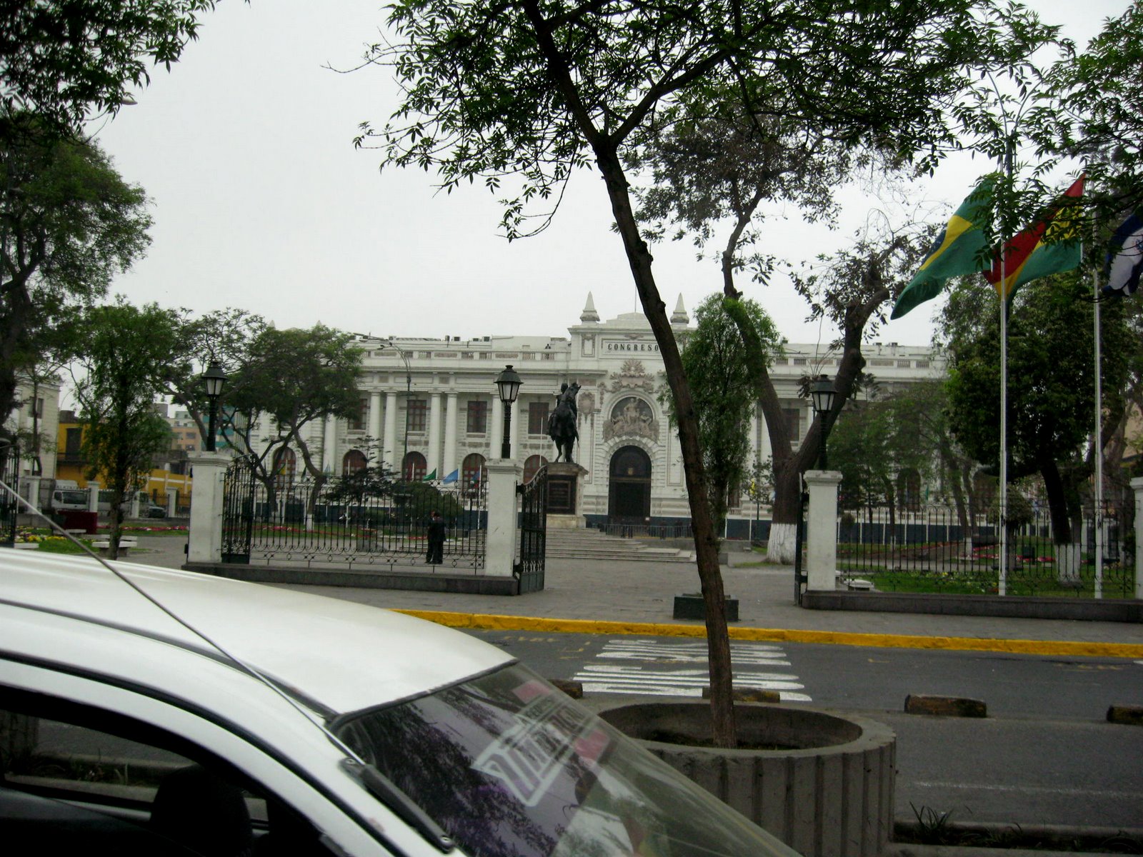
Downtown Lima is busy and congested like all big cities.  The buildings are varied in size, shape and color.  Governmental buildings are easy to identify adorned with statues, fences and reasonable colors.  Others are plainer and colors straight out of a bad dream.  One circle-O (traffic circle) was surrounded by six blue - five story somethings.  Ghastly !


Because it doesn't rain in Lima, ( I didn't see any automatic systems,) all the plants require watering by hand.  Trucks bring water to parks or they are flooded from a central outlet used to feed the  open trenches.  The parks are generally well adorned with flowers and trees with benches for visitors to relax.  Most are fenced or protected from drivers on the loose.  Animals are infrequently seen, no cats or dogs unless the dogs are on leashes.  In the poorer neighborhoods there are dog packs running here and there.  Safety in the streets is a concern after dark. 
Locals say the city neighborhoods are either A, B or C with some X.  A is the best so imagine the X ones.  No walking there anytime of the day or night in those.  Generally, the A neighborhoods are very nicely maintained but the traffic is still an issue.  Being alert at the crossings is essential.  Drivers have the right of way always.  Streets in the neighborhoods are usually adorned with lombadas or traffic bumps to maintain moderate speeds.  Taxis are not as we see in other parts of the world.  Cars are usually compact or smaller.  No such thing as Yellow Cab or properly authorized and not ripping people off. Prices are negotiated before you hire the cabs.  Haggling is everywhere.  No set prices generally.

Neighborhood classification is likely a 'C' here.  Buses give access out of the central part with no other mass transit system.  Lima would benefit from a train system for these outlying places but they would need to be manned to protect the equipment.  Along side almost every road there are street vendors selling anything from food to merchandise.  It's wise to be cautious about consuming anything from the street vendors.  Never the less, these vendors are simple and hard working.  Is there ever an end to the poor and needy? 


Cesar speaks English and was immeasurably helpful describing the scenes along the way.  Local customs, ethnicity or dialect could vary as the city faded into country side.  Depending on the distance from the water, agriculture popped into view now and then.  Most of the landscape was barren.  It reminded us of something we'd image from the mid-east.  Nothing  but sand or dirt on rocky ridges with absolutely no vegetation of any kind.  In the ocean side lowlands green belts emerged sporting every product from sugarcane, corn, apples, strawberries, bananas etc.  Most fields were row crop varieties.  Goat herds rattled by occasionally with herdsmen attending.
Merchandising is very unique.  Construction materials included bamboo poles, pre-fab walls usually 8 x 12 or other simple dimensions.  Sheets of woven fiber about 4x8 were stacked along side.  Merchants occupied very small kiosks arranged immediately beside many others who were selling the same product or service.  These people seem to be very diligent and hard working.  Most arrive early and stay very late.  Here is a merchants place of business with an average sized taxi in front.  Many many taxis cruise the streets, honking quickly to alert any potential customer.  If you're walking expect constant invitations use them. 

Neighborhood class for this area is C or a little lower.  The higher up on the hill, the lower the class.  No streets or sidewalks exist here so anything you take home is carried.  No plumbing with only slit trenches for plumbing.  Sanitation is non existent.  The neighborhoods furthest from town were the poorest because of access to transportation.  Few buildings are completed.  Re-bar extends from the upper stories and most of the structure is unoccupied.  Finishing a project seems like the toughest things to do.  Some say unfinished buildings are not taxed but that's not for certain.  All construction is cement and ceramic.  Wood construction would be a fire trap and such a fire would take out whole neighborhoods.

The Pan-American Highway (Portuguese: Rodovia / Auto-estrada Pan-americana, Spanish: Carretera Panamericana or Spanish: Autopista Panamericana) is a network of roads measuring about 47,958 kilometres (29,800 mi) in total length. Except for an 87 kilometres (54 mi) rainforest break, called the Darién Gap, the road links the mainland nations of the Americas in a connected highway system. According to Guinness World Records, the Pan-American Highway is the world's longest "motorable road". However, because of the Darién Gap, it is not possible to cross between South America and Central America by traditional motor vehicle.

The Pan-American Highway system is mostly complete and extends from Prudhoe Bay, Alaska, in North America to the lower reaches of South America. Several highway termini are claimed to exist, including the cities of Puerto Montt and Quellón in Chile and Ushuaia in Argentina. No comprehensive route is officially defined in Canada and the United States, though several highways in the U.S. are called "Pan-American". 
It passes through many diverse climates and ecological types, from dense jungles, to arid deserts, to cold mountain passes. Since the highway passes through many countries, it is far from uniform. Some stretches of the highway are passable only during the dry season, and in many regions driving is occasionally hazardous.  This part is divided with two lanes in each direction.

Famous sections include the Alaska Highway and the Inter-American Highway (the section between the United States and the Panama Canal). Both of these sections were built during World War II as a means of supply of remote areas without danger of attack by U-boats.


Jake Silverstein, writing in 2006, described the Pan-American Highway as "a system so vast, so incomplete, and so incomprehensible it is not so much a road as it is the idea of Pan-Americanism itself…"

Along this vast stretch of coastal plain, the entrance to Caral is difficult to locate.  There is no advertising and no signage to point the way
If it hadn't been for George's GPS, we would have had to resort to asking more locals how to find the access road...or trail as it turned out to be.  Along the trail we'd find painted walls now and then with reassurance of being on course.  Most of these walls are adobe which continues to be used in construction of anything from a home to a partition wall or gateway.  Paint is usually a homemade product using plants or fruits for coloring.  All humanity receded behind us with a few km of the highway leaving only the trail of dust and rocks


Plants spring up everywhere there is moisture.  Roadside flowers adorn the trail before in places we reach a homestead. Children playing with their puppy and stacks of bricks in front of a Palo Verde tree and field of crops was the common sight.  Several turns later and we approached a bridge over this canal. 


This irrigation canal is supplied from the Rio Supe.  Electrical poles seem to invite us to continue in their direction. They must supply needs this way. Despite the canal, no real vegetation grows from here to Caral until you reach the Supe Valley about 14 km ahead.  An amazing phenomenon was the availability of cell phone signal almost everywhere. 


Our first trail took us into a chicken raising area where very large raising barns sit quietly on the floor of the valley.  Because of disease being introduced by clinging to the outside of the van or on the tires, the vehicle had to be sprayed with DDT (yes).  It is used in parts of the world just like this.  The applicator wore no mask or protection as he cranked up the pump and sprayed the vehicle.  Windows rolled up tightly protected everything inside, including all of us. Sign reads -  forbidden to enter of vehicles and people. Not authorized to enter any vehicle without washing and Disinfecting.


If you come to a fork in the road - Take it !  good advise if you know which fork is the best one.  Three tries took us to parts unknown, on foot investigation of the depth of the sand underfoot was required if we didn't want to get stuck.  The driver didn't risk getting this highway beast buried in the sand so he backed up each time.  The last time he did find a hard pack to turn around.  No signs to show the way, unless you count piles of rocks of some derivation we knew not what. 


 The inspection team of highly skilled gringos and one truly talented Latin brother inspected the terrain, soil conditions, took readings of the rainfall and generally wasted itself with advise.  Our work wasn't totally in vain, as we discovered the general direction using the GPS and walking a little to establish our position in relation to the real way to Caral.


Thursday, November 3, 2011

La Casa del Señor.

 The view from across the main street in La Molina looking back at the Temple and the Hospitaje on Monday October 31.  Adjoining the Temple, those coming from longer distances will have housing and food available.  There is a present Comodora to feed travelers and others.  That facility will be replaced in the 1st floor, hostel housing on the 2nd floor and missionary housing on the 3rd.  We'll be moving into our apartmento in February.  Can you wait for that?  We'll be excited to be there so we don't have to commute.  Today was shopping in the morning.  We walked over to Jockey Plaza, got some groceries then caught a cab back home.  That cost us 8 soles.  1sole is about 40 cents. 
 Potential tenants were found wandering through the apartments on Monday and a security camera caught this candid shot.  If you know them, send their names to the security department for prosecution.  Penalties include fresh fruits and vegetable on demand.  Amenities will be plentiful, mostly a wide variety of domestic benefits to lighten the mood while we're away from home and our families. 
These people include our Temple President, Robert Lees, Larry and Elrain Thompson from South Jordon, Ut, Bob and Porsche Neville from Glendale AZ, and Claudia and Max Simmons.  One additional couple stayed home, the Spencers from Mesa, AZ.  These are really good people with whom we'll work for the next two years.  We all are scheduled to be here until Oct 31, 2013.  Because we share an apartment with the Thompsons, we don't work when they work.  When we're working they get the apartment to themselves.  This week we'll be doing the afternoon to close hours.  Next week it will be our time to do the mornings. 

We discovered we don't know too much about Spanish food labels.  We shopped for supplies and food without our dictionary.  It was painful but...we didn't do terribly.  The other shoppers spoke no English.  The variety was like Monday although we went to a completely different market (marcado).  There is an endless supply of fish, bread, rice, pastry and all the normal things you buy in the Estados Unidos. (U.S)  The big difference, the labels.  We're drinking from the fire hose these days, in language learning. Every day bombarded by new people, new words, new situations.  Today was even more pressure.  I really think it will test our upper limits of learning.  I can learn these words, I just can say them all.  My mouth doesn't do Spanish comfortably and my tongue is even more unfriendly with them.  The alphabet is almost the same just a few more letters but recognizable.  As of today, three natives have offered to help me learn.  There may be a lesson in how badly I'm saying things.  As I told my kids when they were young, Spanish is easy, just add an 'O' to everything and you're ok.   Right.   !